Description
Uluabat Lake
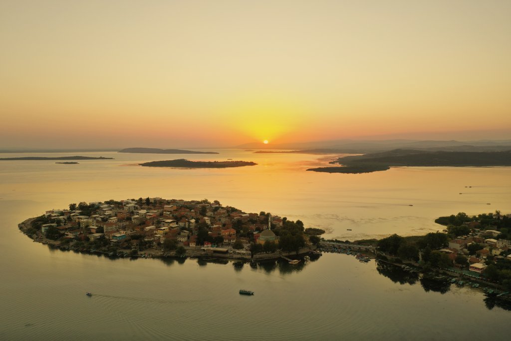
Uluabat Lake, 30 km from Bursa, extends in the east-west direction. The length of the lake is 24 km and its width is 10 km. The source that feeds the lake is Mustafakemalpaşa Stream and it enters from the south of the lake. The exit of the lake takes place with Koca Çay from the west of the lake and finally ends in the Marmara Sea. Uluabat Lake is one of the most important wetlands not only in our country but also in Europe and the Middle East. Due to this importance, it was designated and protected as a RAMSAR protection zone by the Ministry of Environment in 1998, and then included in the International Living Lakes Network at the 4th International EXPO 2000 conference. There are 11 islands of different sizes in the lake, which is also called Apolyont Lake. The biggest of these is Halil Bey Island.
Uluabat Lake; it is a shallow, cloudy, overtrophic freshwater lake. It has varying water level depending on the season. As a result of the studies carried out in the lake, 21 fish species have been identified. Among these species, the main ones that are hunted for commercial purposes are; crane and carp. Small quantities of cattle, freshwater mullet, herring, red-wing fish and crayfish are caught. Ulubat Lake, which has gained the status of an important Bird Area, is an important breeding area for small cormorants, pied heron and spoonbill. In winter, there are large numbers of water birds in the lake, among which small cormorants, crested pelican, almabaç patka, crested patka and coot can be observed. Other important birds breeding in the lake include the little egret and paddy. Uluabat Lake, which is located on one of the important bird migration routes extending from Europe to Asia, hosts many storks every year. The most important activity on the lake is a 4-season boat trip. Women living in Göyazı also go out fishing and the fish that are caught are sold at an auction in Gölyazı square.
Adres
Between Karacabey and Mustafakemalpaşa, Bursa


Add a review